Kyoto Maps and Orientation
(Kyoto, Kansai, Central Honshu, Japan)
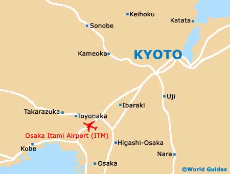
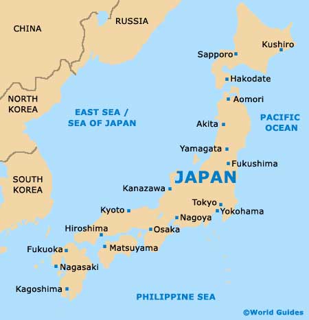
Kyoto is a great place to stay and is located in the Kyoto Prefecture, part of the Kansai region. Capital of the prefecture, Kyoto is well-placed for exploring this part of Japan, being especially close to Kobe,
Osaka and
Nagoya, amongst other locations worth visiting.
Whilst Kyoto is a large and densely populated city, it is fairly easy to get around. On the southern side of the city you will find Kyoto Station, serving Japan and also the Kintetsu Railway network. Nearby, the Karasuma-dori is an important local thoroughfare that stretches northwards, towards the city's commercial centre.
Maps and Orientation of the City
The main area of commerce in Kyoto is sandwiched between the Sanjo-dori, the Shiro-dori, the Karasuma-dori and also the Kawaramachi-dori. This district is also known for its nightlife and soon begins to fill up when the sun goes down.
Central Kyoto contains plenty of interest for the tourist, although many of the best sights lie in the city's suburbs, particularly to the east and west of central Kyoto. These areas are simple to reach and locals often choose to either cycle or use one of the many regular buses.
Outside of Kyoto are many charming mountain villages, all of which make popular day excursions and have much to offer. Highlights include the villages of Kurama, Ohara and Takao, while other nearby locations close to Kyoto are as follows.
- Hikone - north-east
- Himeji - south-west
- Hirakata - south
- Kaibara - north-west
- Kameoka - west
- Kameyama - south-east
- Kobe - south-west
- Miyama - north-west
- Nagahama - north-east
- Nagoya - east
- Nara - south
- Omihachiman - north-east
- Osaka - south
- Otsu - east
- Ueno - south-east
- Yokaichi - east
Map of Japan
Map of Kyoto